Top 10 Beautiful Lake Tahoe Hiking Trails to do this Fall
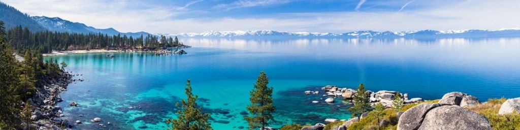
 Name: DL Bliss State Park to Emerald Bay (the Rubicon Trail)
Difficulty: Moderate
Miles: 7.3
Dog Friendly: No
Route Type: Out and Back
Elevation Gain: 1,158 ft
Location: South Lake Tahoe | Google Map
Description: This well-maintained trail connects DL Bliss State Park to Emerald Bay State Park offers spectacular views of Lake Tahoe. The terrain is relatively flat, making it a great hike for kids. Note that dogs are not allowed on this trail.
More Info: DL Bliss California Parks Page
 Name: Desolation Wilderness-Middle Velma Lake Trail
Difficulty: Moderate
Miles: 8.2
Dog Friendly: Yes
Route Type: Out and Back
Elevation Gain: 2,263 ft
Location: South Lake Tahoe | Desolation Wilderness Google Map
Description: This is a pleasant hike with a picturesque alpine lake setting. The trail starts out with great views of Eagle Falls and mountain terrain.
More Info: Desolation Wilderness All Trails Info
 Name: Mt Rose
Difficulty: Moderate
Miles: 10.6
Dog Friendly: Yes
Route Type: Out and Back
Elevation Gain: 2,444
Location: North Lake Tahoe | Mt Rose Google Map
Description: Despite its 2,400 foot elevation gain, the hike to the summit of Mt Rose is relatively moderate and quite pleasant in the fall. After crossing Galena Creek the hike becomes a bit more challenging but it's well worth the views from the top.
More Info: Mt Rose All Trails Info
 Name: Mt Judah
Difficulty: Moderate
Miles: 5.1
Dog Friendly: Yes
Route Type: Loop
Elevation Gain: 1,312 ft
Location: Near Truckee, CA | Mt Judah Google Map
Description: This moderately difficult loop trail is a good mix of gentle grades with a few steep sections and offers great views of Donner Lake and surrounding peaks, as well as gorgeous wildflowers.
More Info: Donner Summit Historical Society
 Name: Mt Lola
Difficulty: Difficult
Miles: 12.3
Dog Friendly: YES
Route Type: Out and Back
Elevation Gain: 2,555 ft
Location: Near Sierraville, CA | Mt Lola Google Map
Description: This hike is a moderate climb upward through trees and beautiful meadows of wildflowers, along Cold Stream to the top of Mt Lola (the highest peak in the Tahoe National Forest). Stunning views of the Sierra Divide can be taken in from the summit.
More Info: Mt Lola Forest Service Info
 Name: Brockway Summit to Watson Lake (Watson Lake Trail)
Difficulty: Moderate
Miles: 13.4
Dog Friendly: Yes
Route Type: Out and Back
Elevation Gain: 1,450
Location: North Lake Tahoe | Brockway Summit Google Map
Description: This section of the Tahoe Rim Trail is a challenging climb with areas of steep terrain. There are great lookout points to take in the beauty of Lake Tahoe. As you pass through fields of wildflowers and by several streams you will be met with breathtaking views
More Info: Tahoe Rim Trail
 Name: Upper Coldstream Canyon Trail
Difficulty: Moderate
Miles: 4.6
Dog Friendly: Yes
Route Type: Out and Back
Elevation Gain: 734
Location: Near Truckee, CA at Donner Memorial State Park | Google Map
Description: This rather relaxing hike is short and sweet, perfect for a quick afternoon hike. It's a popular cross-country ski trail when the snow hits.
More Info: Coldstream Canyon Info
 Name: Mt Tallac
Difficulty: Easy from trailhead to Floating Island Lake and Cathedral Lake (approx 3.5 miles) from there to the summit is rated as difficult
Miles: 10.2
Dog Friendly: Yes
Route Type: Out and Back
Elevation Gain: 3,418
Location: South Lake Tahoe | Mt Tallac Google Map
Description: Mt Tallac is Lake Tahoe’s highest peak and the summit is the very best spot to take in panoramic views of the Tahoe, Fallen Leaf Lake, Desolation Wilderness and surrounding peaks. It is a favorite among hikers. with terrain that is quite challenging in some areas, but well worth every strenuous step.
More Info: Mt Tallac Forest Service Info
 Name: Five Lakes Trail
Difficulty: Moderate
Miles: 4.7
Dog Friendly: Yes
Route Type: Out and Back
Elevation Gain: 1,151
Location: Near Alpine Meadows, CA | Five Lakes Trail Google Map
Description: The Five Lakes Trail is one of the easiest and most accessible hikes in the Granite Chief Wilderness, so it tends to be busy. But don’t let that deter you from exploring the beautiful terrain and a relaxing lake.
More Info: Five Lakes Trail Info
 Name: Stateline Fire Lookout
Difficulty: Easy
Miles: 1.5
Dog Friendly: YES
Route Type: Loop
Elevation Gain: 301 ft
Location: South Lake Tahoe | Stateline Fire Lookout Google Map
Description: Once a fire lookout, this short, easy hike offers beautiful views of Lake Tahoe. There are some side trails to explore, a granite patio, free telescopes and benches to enjoy the view, as well as a short self-guided nature trail located near the lookout.
More Info: Stateline Forest Lookout Forest Service Info


